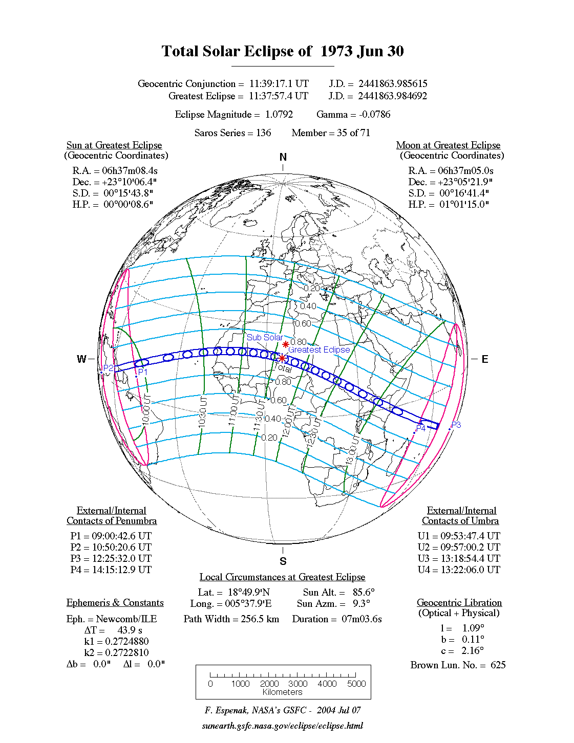
![]() De zonsverduistering was te zien tussen de blauwe lijnen.
De zonsverduistering was te zien tussen de blauwe lijnen.
De totale zonsverduistering van 30 juni 1973 trok veel over land en zee en was achtereenvolgens te zien op of in deze zestien (ei)landen: Brazilië, Guyana, Suriname, Santo Antão, São Vicente, Mauritanië, Mali, Algerije, Niger, Tsjaad, Soedan, Democratische Republiek Congo, Zuid-Soedan, Oeganda, Kenia en Somalië.[1][2]
Lengte
Maximum
Het punt met maximale totaliteit lag in Niger vlakbij Assamakka en duurde 7m03,5s.
Limieten
| Fenomeen |
Code |
Tijdstip UTC
|
| Eerste contact bijschaduw |
P1 |
09:00:42.6
|
| Eerste contact kernschaduw |
U1 |
09:53:47.4
|
| Kernschaduw compleet vanaf |
U2 |
09:57:00.2
|
| Bijschaduw compleet vanaf |
P2 |
10:50:20.6
|
| Maximum eclips |
GE |
11:37:57.4
|
| Bijschaduw compleet t/m |
P3 |
12:25:32.0
|
| Kernschaduw compleet t/m |
U3 |
13:18:54.4
|
| Laatste contact kernschaduw |
U4 |
13:22:06.0
|
| Laatste contact bijschaduw |
P4 |
14:15:12.9
|
Zie ook
Externe links
Bronnen, noten en/of referenties
