Approximately 70% of the families in Kafr ad-Dik are dependent on agriculture as the main source of income, while the remaining 30% work in the private and public sectors. The unemployment rate in the town is 60%.[4]
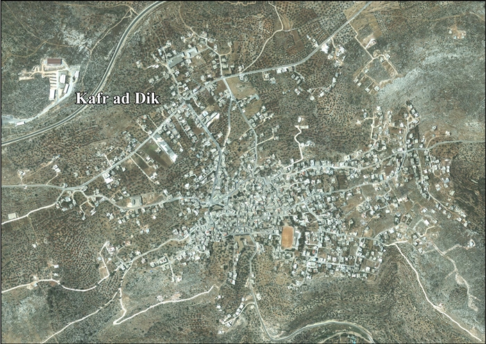
The town's total land area consists of 15,228 dunams of which 578 dunams are built-up. In the town's area, the archaeological ruins of Deir Samaan are located.
It has been suggested that this is the place mentioned in Crusader sources under the name of Caphaer; a village connected with the Casale Santa Maria.[7] In 1175, Crusader sources mentions a former cistern-keeper of the village.[8] In 1176, the revenues from Caphaer (=Kafr ad-Dik) and caslia S. Maria (=Aboud) were given for the provision of white bread for the sick in the Hospital in Jerusalem.[9]
It has been suggested that this village is the Kafr Bani Hamid of the 1596 Ottomantax records, with 83 Muslim families.[11]
In the 18th and 19th centuries, the village formed part of the highland region known as Jūrat ‘Amra or Bilād Jammā‘īn. Situated between Dayr Ghassāna in the south and the present Route 5 in the north, and between Majdal Yābā in the west and Jammā‘īn, Mardā and Kifl Ḥāris in the east, this area served, according to historian Roy Marom, "as a buffer zone between the political-economic-social units of the Jerusalem and the Nablus regions. On the political level, it suffered from instability due to the migration of the Bedouin tribes and the constant competition among local clans for the right to collect taxes on behalf of the Ottoman authorities."[12]
In 1838 it was noted as a village el-Kufr, part of the Jurat Merda district, south of Nablus.[13]
In 1870 Victor Guérin found here very considerable remains. They included two birkets cut in the rock, one 15 paces long by 12 broad, the other not quite so large; about 30 cisterns and 20 tombs cut in the rock, some with sepulchral chambers, their walls pierced with loculi, others simple graves, either intended for a single body or having right and left vaulted tombs with arcosolia. These graves were formerly covered with stone slabs. There were also several lintels, decorated with the rectangular cartouche, on either side of which were triangles, and in the middle a cross. There are four mosques, built with stones and columns belonging to a Christian church. There is also a square tower, measuring 7 paces on each side. It is lit by loopholes, and is covered with immense slabs forming a roof, and supported by vaulted arcades. Within it is a cistern. On the lintel is a cross with equal branches inserted in a circle near four semicircles, which lie in a four-leaved rose. This tower formed part of a larger building, now destroyed.[14]
Guérin noticed houses which were constructed from red and white stone masonry, as in Deir Ghassaneh and Beit Rima.[15]
In 1870/1871 (1288 AH), an Ottoman census listed the village in the nahiya (sub-district) of Jamma'in al-Thani, subordinate to Nablus.[16]
In 1882, the PEF's Survey of Western Palestine described the village as being "of moderate size on the hillside, and an ancient site, having rock-cut tombs to the east."[17]
In the 1945 statistics the population was 870, all Muslims,[20] while the total land area was 15,308 dunams, according to an official land and population survey.[21] Of this, 2,075 were used for plantations and irrigable land, 2,603 for cereals,[22] while 58 dunams were classified as built-up areas.[23]
After the 1995 accords, 14.5% of village land was classified as Area B, the remaining 85.5% as Area C. Israel has confiscated land from Kafr ad-Dik for Israeli settlements numerous times, including:
246 dunams for an industrial zone, near Pedu'el.[25]
After an Israeli court approved the expropriation of 3,000 dunams (750 acres) of private Palestinian land in Kafr ad-Dik's Thahir Subih neighborhood, bulldozers were called in and reportedly uprooted dozens of olive trees and fruit trees while leveling over 10,000 dunams (2,500 acres). The Israel Civil Administration spokesperson said the works related to a state-backed plan to develop the area's agriculture. In Israel's view, the spokesperson added, these are Israeli state lands.[26]
Demography
Diaspora
Kafr ad-Dik has a considerable diaspora. People of several villages, including Deir Istiya, Sanniriya, Kafr Jammal, Attil, Annaba, Ballut, among others, as well as people from the city of Nablus, can trace their ancestry back to this village.[27]
^Finkelstein, Israel; Lederman, Zvi; Bunimovitz, Shlomo (1997). Finkelstein, Israel; Lederman, Zvi (eds.). Highlands of Many Cultures. Jerusalem: Institute of Archaeology of Tel Aviv University Publications Section. pp. 267–268. ISBN965-440-007-3.
^Grossman, D. (1986). "Oscillations in the Rural Settlement of Samaria and Judaea in the Ottoman Period". in Shomron studies. Dar, S., Safrai, S., (eds). Tel Aviv: Hakibbutz Hameuchad Publishing House. p. 354


