Share to: share facebook share twitter share wa share telegram print page

Forsyth County, North Carolina

Forsyth County
Forsyth County Courthouse in Winston-Salem
Flag of Forsyth County
Official seal of Forsyth County
Official logo of Forsyth County
Map of North Carolina highlighting Forsyth County
Location within the U.S. state of North Carolina
Map of the United States highlighting North Carolina
North Carolina's location within the U.S.
Coordinates: 36°08′N 80°16′W / 36.13°N 80.26°W / 36.13; -80.26
Country United States
State North Carolina
Founded1849
Named forBenjamin Forsyth
SeatWinston-Salem
Largest communityWinston-Salem
Area
 • Total412.35 sq mi (1,068.0 km2)
 • Land407.85 sq mi (1,056.3 km2)
 • Water4.50 sq mi (11.7 km2)  1.09%
Population
 (2020)
 • Total382,590
 • Estimate 
(2023)
392,921
 • Density937.7/sq mi (362.0/km2)
Time zoneUTC−5 (Eastern)
 • Summer (DST)UTC−4 (EDT)
Congressional districts5th, 6th
Websitewww.co.forsyth.nc.us

Forsyth County (/frˈsθ/ fohr-SYTH)[1][2] is located in the northwest Piedmont of the U.S. state of North Carolina. As of the 2020 census, the population was 382,590,[3] making it the fourth-most populous county in North Carolina. Its county seat is Winston-Salem.[4] Forsyth County is part of the Winston-Salem, NC, Metropolitan Statistical Area, which is also included in the Greensboro–Winston-Salem–High Point, NC, Combined Statistical Area. Portions of Forsyth County are in the Yadkin Valley wine region.

History

The county was formed in 1849 from Stokes County. It was named for Colonel Benjamin Forsyth, who was killed in the War of 1812.[5]

Geography

Map
Interactive map of Forsyth County

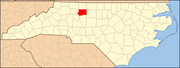
According to the U.S. Census Bureau, the county is in the outer Appalachian Mountains, and has a total area of 412.35 square miles (1,068.0 km2), of which 407.85 square miles (1,056.3 km2) is land and 4.50 square miles (11.7 km2) (1.09%) is water.[6]

The northeast section of Forsyth County, including Belews Creek and parts of Rural Hall, Walkertown, and Kernersville, is drained by tributaries of the Dan River. A small portion of Kernersville is in the Cape Fear River basin.[7] Most of the county is drained by tributaries of the Yadkin River, which forms the western boundary of the county. The lowest elevation in the county is 660 feet, on the Yadkin River at the southwest corner of the county.[8] The highest is 1100 feet, at a point just off Jefferson Church Road on the outskirts of King, immediately south of the county line.

State and local protected areas/sites

Major water bodies

Adjacent counties

Major highways

Major infrastructure

Demographics

Historical population
CensusPop.Note
185011,168
186012,69213.6%
187013,0502.8%
188018,07038.5%
189028,43457.4%
190035,26124.0%
191047,31134.2%
192077,26963.3%
1930111,68144.5%
1940126,47513.2%
1950146,13515.5%
1960189,42829.6%
1970214,34813.2%
1980243,68313.7%
1990265,8789.1%
2000306,06715.1%
2010350,67014.6%
2020382,5909.1%
2023 (est.)392,921[3]2.7%
U.S. Decennial Census[9]
1790–1960[10] 1900–1990[11]
1990–2000[12] 2010[13] 2020[3]

2020 census

Forsyth County racial composition[14]
Race Number Percentage
White (non-Hispanic) 208,126 54.4%
Black or African American (non-Hispanic) 93,738 24.5%
Native American 978 0.26%
Asian 9,179 2.4%
Pacific Islander 233 0.06%
Other/Mixed 15,648 4.09%
Hispanic or Latino 54,688 14.29%

As of the 2020 census, there were 382,590 people, 148,151 households, and 90,837 families residing in the county.

2000 census

At the 2000 census,[15] there were 306,067 people, 123,851 households, and 81,741 families residing in the county. The population density was 747 people per square mile (288 people/km2). There were 133,093 housing units, at an average density of 325 units per square mile (125 units/km2). The racial makeup was 68.47% White, 25.61% Black or African American, 0.30% Native American, 1.04% Asian, 0.03% Pacific Islander, 3.25% from other races, and 1.30% from two or more races. 6.40% of the population were Hispanic or Latino of any race.

There were 123,851 households, out of which 30.50% had children under the age of 18 living with them, 48.90% were married couples living together, 13.50% had a female householder with no husband present, and 34.00% were non-families. 28.90% of all households were made up of individuals, and 9.30% had someone living alone who was 65 years of age or older. The average household size was 2.39, and the average family size was 2.94.

Map of census tracts in Forsyth County by racial plurality, per the 2020 US Census
Legend

The median age was 36 years, with 23.90% under the age of 18, 9.60% from 18 to 24, 31.10% from 25 to 44, 22.80% from 45 to 64, and 12.60% who were 65 years of age or older. For every 100 females there were 91.50 males. For every 100 females age 18 and over, there were 87.40 males.

The median household income was $42,097, and the median family income was $52,032. Males had a median income of $36,158, versus $27,319 for females. The per capita income was $23,023. About 7.90% of families and 11.00% of the population were below the poverty line, including 15.10% of those under age 18 and 9.70% of those age 65 or over.

Law and government

Forsyth County Public Safety Center

The Forsyth County Government Center is located at 201 North Chestnut Street in Downtown Winston-Salem. Forsyth County is a member of the regional Northwest Piedmont Council of Governments.

The Forsyth County Public Library, founded in 1906, is free for residents of Forsyth and surrounding counties, while all others must pay a small yearly fee for a library card. The library runs Adult, Children's, and Hispanic Outreach programs. Its main "Central Library" is in downtown Winston-Salem, with branches all across the county.[16]

The Forsyth County Department of Public Health is located at 799 North Highland Avenue near downtown Winston-Salem.

Politics

Forsyth County typically favors Democratic candidates in national elections, though Republicans remain competitive in local races.[17]

United States presidential election results for Forsyth County, North Carolina[18]
Year Republican Democratic Third party
No.  % No.  % No.  %
2020 85,064 42.26% 113,033 56.16% 3,173 1.58%
2016 75,975 42.61% 94,464 52.98% 7,873 4.42%
2012 79,768 45.83% 92,323 53.04% 1,978 1.14%
2008 73,674 44.35% 91,085 54.83% 1,374 0.83%
2004 75,294 54.12% 63,340 45.53% 491 0.35%
2000 67,700 55.98% 52,457 43.37% 785 0.65%
1996 59,160 52.81% 46,543 41.54% 6,330 5.65%
1992 52,787 45.40% 49,006 42.15% 14,481 12.45%
1988 57,688 59.02% 39,726 40.65% 321 0.33%
1984 59,208 61.54% 36,814 38.26% 189 0.20%
1980 42,389 49.99% 38,870 45.84% 3,539 4.17%
1976 38,886 49.34% 39,561 50.20% 361 0.46%
1972 46,415 67.69% 20,928 30.52% 1,226 1.79%
1968 31,623 46.79% 20,281 30.01% 15,681 23.20%
1964 30,276 48.92% 31,615 51.08% 0 0.00%
1960 33,374 58.13% 24,035 41.87% 0 0.00%
1956 29,368 64.99% 15,819 35.01% 0 0.00%
1952 26,436 51.86% 24,535 48.14% 0 0.00%
1948 10,147 41.04% 12,201 49.35% 2,377 9.61%
1944 10,014 37.93% 16,390 62.07% 0 0.00%
1940 7,125 25.64% 20,664 74.36% 0 0.00%
1936 5,256 21.91% 18,734 78.09% 0 0.00%
1932 5,727 28.49% 14,016 69.73% 357 1.78%
1928 13,258 66.63% 6,639 33.37% 0 0.00%
1924 5,315 40.33% 7,404 56.18% 459 3.48%
1920 6,792 45.54% 8,123 54.46% 0 0.00%
1916 3,585 45.16% 4,115 51.84% 238 3.00%
1912 1,689 26.72% 3,042 48.12% 1,591 25.17%
1908 2,876 52.28% 2,472 44.94% 153 2.78%
1904 2,209 47.94% 2,301 49.93% 98 2.13%
1900 2,588 50.77% 2,482 48.70% 27 0.53%
1896 3,888 57.85% 2,778 41.33% 55 0.82%
1892 2,447 42.13% 2,880 49.59% 481 8.28%
1888 2,613 53.28% 2,238 45.64% 53 1.08%
1884 1,941 48.46% 2,060 51.44% 4 0.10%
1880 1,791 49.42% 1,778 49.06% 55 1.52%

Education

Forsyth County is served by the Winston-Salem/Forsyth County Schools School district.

Communities

Map of Forsyth County with municipal and township labels

Cities

  • Winston-Salem (county seat and largest community)
  • High Point (mostly in Guilford County; also in Randolph County and Davidson County)
  • King (mostly in Stokes County)

Towns

Villages

Townships

Former township

Census-designated place

Unincorporated communities

See also

References

  1. ^ "NC Pronunciation Guide". WRAL. Retrieved August 16, 2023.
  2. ^ Talk Like a Tarheel Archived June 22, 2013, at the Wayback Machine, from the North Carolina Collection website at the University of North Carolina at Chapel Hill. Retrieved August 16, 2023.
  3. ^ a b c "QuickFacts: Forsyth County, North Carolina". United States Census Bureau. Retrieved March 21, 2024.
  4. ^ "Find a County". National Association of Counties. Archived from the original on May 31, 2011. Retrieved June 7, 2011.
  5. ^ Gannett, Henry (1905). The Origin of Certain Place Names in the United States. Govt. Print. Off. pp. 128.
  6. ^ "2020 County Gazetteer Files – North Carolina". United States Census Bureau. August 23, 2022. Retrieved September 9, 2023.
  7. ^ Haw River, North Carolina, American Rivers, Washington, DC. Retrieved December 22, 2021.
  8. ^ Clemmons Topo Map in Forsyth County, NC, TopoZone, Locality, LLC. Retrieved December 22, 2021.
  9. ^ "U.S. Decennial Census". United States Census Bureau. Retrieved January 14, 2015.
  10. ^ "Historical Census Browser". University of Virginia Library. Retrieved January 14, 2015.
  11. ^ Forstall, Richard L., ed. (March 27, 1995). "Population of Counties by Decennial Census: 1900 to 1990". United States Census Bureau. Retrieved January 14, 2015.
  12. ^ "Census 2000 PHC-T-4. Ranking Tables for Counties: 1990 and 2000" (PDF). United States Census Bureau. April 2, 2001. Archived (PDF) from the original on March 27, 2010. Retrieved January 14, 2015.
  13. ^ "State & County QuickFacts". United States Census Bureau. Retrieved February 15, 2022.
  14. ^ "Explore Census Data". data.census.gov. Retrieved December 20, 2021.
  15. ^ "U.S. Census website". United States Census Bureau. Retrieved January 31, 2008.
  16. ^ "Locations". Forsyth County Public Library website. Forsyth County. Retrieved June 6, 2012.
  17. ^ Gordon, Brian (April 25, 2022). "Why do conservative WNC counties keep electing Democrats?". The Fayetteville Observer. Retrieved November 9, 2023.
  18. ^ Leip, David. "Dave Leip's Atlas of U.S. Presidential Elections". uselectionatlas.org. Retrieved March 15, 2018.
  19. ^ "Middle Fork Township". Geographic Names Information System. United States Geological Survey, United States Department of the Interior.

External links

Read more information:

D'AcademyMusim 1Penayangan3 Februari 2014 (2014-02-03) – 30 Mei 2014 (2014-05-30)JuriBeniqnoIis DahliaInul DaratistaRita SugiartoSaipul JamilIvan GunawanPembawa acaraRamziRina NoseIrfan HakimSaluranIndosiarPeserta35Lokasi finalStudio 5 IndosiarPemenangLesti KejoraAsalCianjurLagu kemenanganKejoraGenreDangdutJuara duaNur AtyKronologi  2014 ► D'Academy (Musim 1) adalah sebuah ajang pencarian bakat penyanyi dangdut musim pertama dari D'Academy yang ditayangkan di Indosiar. Acara i…

vteSpillover of the1947–48 Civil Warin Mandatory Palestine Aden Manama (Bahrain) Haleb (Syria) Tripolitania 1948 Anti-Jewish Riots in Oujda and Jerada 1948 Cairo bombings Menarsha synagogue attack Part of a series onJewish exodus from the Muslim world Background History of the Jews under Muslim rule Sephardi Mizrahi Yemeni Zionism Arab–Israeli conflict 1948 war Suez Crisis Six-Day War Antisemitism in the Arab world Farhud Aleppo Aden Oujda and Jerada Tripolitania Cairo Baghdad Tripoli Exodus…

2011 single by James WesleyDidn't ISingle by James WesleyReleasedApril 11, 2011 (2011-04-11)GenreCountryLength3:26LabelBroken BowSongwriter(s)Ben GloverKyle JacobsRandy MontanaProducer(s)Rodney ClawsonDan FrizsellJames Wesley singles chronology Real (2010) Didn't I (2011) Walking Contradiction (2012) Didn't I is a song recorded by American country music artist James Wesley. It was released in April 2011. The song was written by Ben Glover, Kyle Jacobs and Randy Montana.[1]…

جزء من السلسلات حولثقافة السودان التاريخ السكان اللغات لغة عربية لهجة سودانية المطبخ الاحتفالات العطل الرسمية الدين الإسلام في السودان المسيحية في السودان اليهودية في السودان الأدب الموسيقى والفنون الموسيقى الإعلام سينما الصحف التلفاز الرياضة المعالم قائمة مواقع التراث…

This article may be too technical for most readers to understand. Please help improve it to make it understandable to non-experts, without removing the technical details. (August 2014) (Learn how and when to remove this template message) Structures for lossless ion manipulations (SLIM) are a form of ion optics to which various radio frequency and dc electric potentials can be applied and used to enable a broad range of ion manipulations, such as separations based upon ion mobility spectrometry, …

Ernest Lawrence Ernest Orlando Lawrence ialah fisikawan Amerika Serikat. Ia lahir pada 8 Agustus 1901 di Canton, South Dakota. Ia menerima gelar sarjana dalam kimia dari Universitas Dakota Selatan pada 1922, gelar master pada 1923 dari Universitas Minnesota, dan Ph.D. dari Universitas Yale pada 1925. Lawrence mengambil kedudukan lektor kepala dalam fisika di Universitas California, Berkeley, pada 1928 dan menjadi profesor termuda di fakultas itu pada 1930. Pada 1929, Lawrence menemukan siklotron…

artikel ini perlu dirapikan agar memenuhi standar Wikipedia. Tidak ada alasan yang diberikan. Silakan kembangkan artikel ini semampu Anda. Merapikan artikel dapat dilakukan dengan wikifikasi atau membagi artikel ke paragraf-paragraf. Jika sudah dirapikan, silakan hapus templat ini. (Pelajari cara dan kapan saatnya untuk menghapus pesan templat ini) Huang Taiji Kaisar kedua Dinasti QingBerkuasa1626 – 21 September 1643PendahuluNurhaciPenerusKaisar ShunzhiInformasi pribadiKelahiran28 November 159…

1974 film by William Rose This article needs additional citations for verification. Please help improve this article by adding citations to reliable sources. Unsourced material may be challenged and removed.Find sources: The Girl in Room 2A – news · newspapers · books · scholar · JSTOR (May 2018) (Learn how and when to remove this template message) The Girl in Room 2ATheatrical release posterItalianLa casa della paura Directed byWilliam RoseScreenplay byG…

Theatre in Mumbai, India Members of the Israel Philharmonic Orchestra rehearse at the Jamshed Bhabha theater before their performance The Jamshed Bhabha Theatre is a 1109-seater theatre inaugurated on 24 November 1999 within The National Centre for the Performing Arts premises in Mumbai, India. It has hosted & staged Indian epics and classical concerts to western operas and ballets. Besides the main auditorium, the theatre has three conference rooms, large foyer spaces and a museum. The acou…

2007 City of Edinburgh Council election ← 2003 3 May 2007 (2007-05-03) 2012 → All 58 seats to Edinburgh City Council30 seats needed for a majority   First party Second party Third party   Party Liberal Democrats Labour SNP Last election 15 seats, 26.9% 30 seats, 27.4%' 0 seats, 15.6% Seats won 17 15 12 Seat change 2 15 12 Popular vote 42,657 44,489 39,431 Percentage 22.0% 22.9% 20.3% Swing 5.00% 4.5% 4.7%   Fourth party Fift…

Local government district in Lincolnshire, England Non-metropolitan district in EnglandSouth Kesteven DistrictNon-metropolitan districtFrom left to rightTop: Grantham skylineMiddle: Stamford and AncasterBottom: Bourne market day and Market Deeping town centre Coat of arms of the district councilShown within the ceremonial county of LincolnshireSovereign stateUnited KingdomConstituent countryEnglandRegionEast MidlandsAdministrative countyLincolnshireFoundedApril 1974Admin. HQGranthamGovernme…

Pan-Asian pay television channel, targeted at children Television channel Cartoon Network (Asia)Broadcast areaAsiaPacific IslandsHeadquartersSingaporeProgrammingLanguage(s)English ChineseMalay IndonesianThaiVietnamesePicture formatHDTV 1080i (downscaled to 480i/576i for the SDTV feed)OwnershipOwnerWarner Bros. Discovery InternationalSister channels Cartoon Network Philippines Cartoonito HBO Family HBO Warner TV HistoryLaunched6 October 1994; 29 years ago (1994-10-06)LinksWebsit…

Uranium enrichment facility in Iran Part of a series on theNuclear program of Iran Timeline Facilities Arak Bushehr Darkhovin Fordow Natanz Isfahan Nuclear Technology/Research Center Karun atomic energy site Organizations Atomic Energy Organization of Iran Oghab 2 International Atomic Energy Agency P5+1 International agreements Non-Proliferation Treaty Additional Protocol 2013 interim agreement, Geneva 2015 prelim agreement, Lausanne 2015 final agreement, Vienna Reactions Aftermath Negotiations …

Village and civil parish in Somerset, England Human settlement in EnglandOver StoweyChurch of St Peter and St PaulOver StoweyLocation within SomersetPopulation352 (2011)[1]OS grid referenceST194398Unitary authoritySomerset CouncilCeremonial countySomersetRegionSouth WestCountryEnglandSovereign stateUnited KingdomPost townBRIDGWATERPostcode districtTA5Dialling code01278PoliceAvon and SomersetFireDevon and SomersetAmbulanceSouth Western UK Parli…

Kevin Lee Informações Nascimento 4 de setembro de 1992 (31 anos)Detroit, Michigan, Estados Unidos Nacionalidade norte-americano Outros nomes The Motown Phenom Altura 1,75 m Peso 70 kg Divisão Peso-leve Envergadura 196 cm[1] Equipe Xtreme Couture (2012–2019) Tristar Gym (2019–presente) Graduação NCAA Divisão II All-American[2] Período em atividade 2012–2023 Cartel nas artes marciais mistas Total 27 Vitórias 19 Por nocaute 3 Por finalização 8 Por decisão 8 Derrotas 8 Por…

American docu-series on Netflix AfflictedGenreDocumentaryNo. of seasons1No. of episodes7ProductionExecutive producersPeter LogrecoDan PartlandCinematographyBen BloodwellBryan DonnellRunning time37–46 minutesProduction companyDoc Shop ProductionsOriginal releaseNetworkNetflixReleaseAugust 10, 2018 (2018-08-10) Afflicted is an American documentary television series on Netflix. The show follows individuals suffering from various chronic diseases and illnesses, seeking treatment and…

2016 American filmKikiFilm posterDirected bySara JordenöWritten bySara JordenöTwiggy Pucci GarçonStarringGia Love, Christopher WaldorfRelease date January 26, 2016 (2016-01-26) (Sundance) Running time96 minutesCountriesUnited StatesSwedenLanguageEnglish Kiki is an American-Swedish co-produced documentary film, released in 2016.[1] It takes place in New York City, and focuses on the drag and voguing scene [and] surveys the lives of LGBT youth of color at a time when …

The vice president is elected indirectly, by an electoral college consisting of members (elected as well as nominated) of both Houses of Parliament, by the system of proportional representation using single transferable votes and the voting is by secret ballot. The election of the vice president is slightly different from the election of the president as the members of state legislatures are not part of the electoral college but the nominated members of Rajya Sabha are part of it.[1][…

Artikel ini tidak memiliki referensi atau sumber tepercaya sehingga isinya tidak bisa dipastikan. Tolong bantu perbaiki artikel ini dengan menambahkan referensi yang layak. Tulisan tanpa sumber dapat dipertanyakan dan dihapus sewaktu-waktu.Cari sumber: Daftar hotel di Kota Surabaya – berita · surat kabar · buku · cendekiawan · JSTOR Berikut adalah daftar beberapa hotel berbintang di Surabaya: Bintang Lima Aliston Papilio by Aliston Ascott Waterplace Surab…

This article is about a song by Aqua. For a song by Oliver popularized by Donovan, see Good Morning Starshine. 1998 single by AquaGood Morning SunshineSingle by Aquafrom the album Aquarium Released14 December 1998 (1998-12-14)[1]Length4:03LabelUniversalSongwriter(s) Søren Rasted Claus Norreen René Dif Producer(s) Johnny Jam Delgado Claus Norreen Søren Rasted Aqua singles chronology Turn Back Time (1998) Good Morning Sunshine (1998) Cartoon Heroes (2000) Music videoGood …

Casino hotel in Las Vegas, Nevada Westgate Las Vegas Resort & CasinoThe property as seen in 2018 Location Winchester, Nevada, U.S. Address 3000 Paradise RoadOpening dateJuly 2, 1969; 54 years ago (1969-07-02) (as The International)No. of rooms2,956Total gaming space54,923 square feet (5,102.5 m2)Permanent showsThe Magic of Jen KramerManilow: The Hits Come HomeNotable restaurantsBenihanaEdge SteakhouseFresco ItalianoSilk Road Asian BistroCasino typeLand-basedOwnerWestga…

High school in New York, United States 40°40′26″N 73°53′47″W / 40.673807°N 73.896276°W / 40.673807; -73.896276 William H. Maxwell Career and Technical High School is a vocational high school in Brooklyn, New York. It lies on Pennsylvania Avenue in the upper half of the East New York neighborhood, close to Liberty Avenue subway station on the C train. The building was built in 1912, but it was re-chartered as a high school in 1950.[1] The school off…

This article is about the district. For its eponymous headquarters, see Jhargram. This article needs additional citations for verification. Please help improve this article by adding citations to reliable sources. Unsourced material may be challenged and removed.Find sources: Jhargram district – news · newspapers · books · scholar · JSTOR (July 2020) (Learn how and when to remove this template message) District in West Bengal, IndiaJhargramDistrict Clockw…

1937 Indian filmBalamaniPosterDirected byP. V. RaoBased onPucca Thirudanby K. Duraiswami AyyangarStarringT. K. ShanmugamT. S. JayaProductioncompanyShanmughananda TalkiesRelease date1937CountryIndiaLanguageTamil Balamani is a 1937 Indian Tamil-language film directed by P. V. Rao and produced by Shanmughananda Talkies. It is based on the two-volume novel of the same name, alternatively titled Pakka Thirudan by Ayyangar. The film stars T. K. Shanmugham, T. S. Jaya, T. K. Muthusami, B. Saradambal, T…

Village in Kuyavian-Pomeranian Voivodeship, PolandRedczyceVillageRedczyceCoordinates: 52°55′N 17°45′E / 52.917°N 17.750°E / 52.917; 17.750Country PolandVoivodeshipKuyavian-PomeranianCountyŻninGminaŻnin Redczyce [rɛtˈt͡ʂɨt͡sɛ] (German Rettschütz) is a village in the administrative district of Gmina Żnin, within Żnin County, Kuyavian-Pomeranian Voivodeship, in north-central Poland.[1] It lies approximately 9 kilometres (6 mi) north-east…

Characteristic of an optical system The numerical aperture with respect to a point P depends on the half-angle, θ1, of the maximum cone of light that can enter or exit the lens and the ambient index of refraction. As a pencil of light goes through a flat plane of glass, its half-angle changes to θ2. Due to Snell's law, the numerical aperture remains the same: NA = n 1 sin ⁡ θ 1 = n 2 sin ⁡ θ 2 . {\displaystyle {\text{NA}}=n_{1}\sin \theta _{1}=n_{2}\sin \theta _{2}.…

قرية بيت العفاري الاعلى  - قرية -  تقسيم إداري البلد  اليمن المحافظة محافظة حجة المديرية مديرية مدينة حجة العزلة عزلة عبس السكان التعداد السكاني 2004 السكان 64   • الذكور 29   • الإناث 35   • عدد الأسر 4   • عدد المساكن 4 معلومات أخرى التوقيت توقيت اليمن (+3 غرين…

For the village, see Hasanlu. For other places with a similar name, see Hasanlu. Rural district in West Azerbaijan province, Iran Rural District in West Azerbaijan, IranHasanlu Rural District Persian: دهستان حسنلوRural DistrictHasanlu Rural DistrictCoordinates: 37°08′58″N 45°28′03″E / 37.14944°N 45.46750°E / 37.14944; 45.46750[1]Country IranProvinceWest AzerbaijanCountyNaqadehDistrictMohammadyarPopulation (2016)[2]…

Transport museum in Glasgow, Scotland. For other uses, see Riverside Museum (disambiguation). Riverside MuseumEstablishedApril 14, 1964; 59 years ago (1964-04-14) (as Glasgow Museum of Transport) June 21, 2011; 12 years ago (2011-06-21) (as Riverside Museum)Location100 Pointhouse Place, Yorkhill, Glasgow, G3 8RS, Scotland (Partick is nearby, across the River Kelvin)Collection size3,000 objectsVisitors1,364,739 (2019)[1]Public transit access Partick sta…

Village in Carmarthenshire, Wales This article needs additional citations for verification. Please help improve this article by adding citations to reliable sources. Unsourced material may be challenged and removed.Find sources: Felinfoel – news · newspapers · books · scholar · JSTOR (August 2017) (Learn how and when to remove this template message) Human settlement in WalesFelinfoelFelinfoel BreweryFelinfoelLocation within CarmarthenshirePopulationNot Re…

Kembali kehalaman sebelumnya