The Bay Ridge–95th Street station (originally 95th Street–Fort Hamilton station) is the southern terminal station on the BMT Fourth Avenue Line of the New York City Subway. Despite the name, the station is located in the neighborhood of Fort Hamilton (as its original name implied) at the intersection of 95th Street and Fourth Avenue in southwestern Brooklyn. It is served by the R train at all times. Geographically, this station is the westernmost New York City Subway station.
The station was first planned in 1922 as the first part of an extension to Staten Island through a tunnel under the Narrows. Construction began on December 17, 1923, after the construction contractor submitted, withdrew, and resubmitted its bid. The station opened on October 31, 1925, but the Staten Island extension was never built due to various funding disputes. The platform was lengthened in the 1960s. A renovation is underway to make the station compliant with the Americans with Disabilities Act of 1990.
History
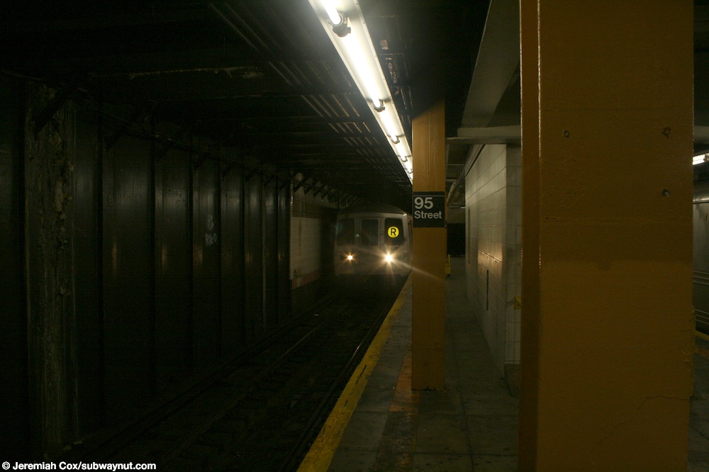
A Forest Hills-bound R train leaving the station
Construction and opening
On August 25, 1922, the Transit Commission directed its chief engineer, Robert Ridgeway, to plan an extension of the Fourth Avenue Line from 87th Street to Fort Hamilton. Initially, multiple stations along the extension were considered. This extension was to be the first part of an extension to Staten Island through a tunnel under The Narrows.[5] On September 12, 1922, a meeting was held by the Transit Commission to determine whether a stop at 91st Street should be included as part of the planned extension. Ultimately, no station was built at 91st Street.[6] At the meeting it was decided that money for an additional station in between 86th Street and the new terminal at 95th Street would be better spent on an extensive terminal with entrances at 93rd, 94th, and 95th Streets.[7] Other extensions were also planned in 1922: a branch of the line running via 86th Street to 18th Avenue to connect with the New Utrecht Line to Coney Island, Route 19, and the future subway under Tenth Avenue, as well as a branch of the line at 67th Street heading to Staten Island, Route 20.[8]
On December 28, 1922, the Transit Commission announced that it had awarded the contract for the construction of a half-mile extension of the Fourth Avenue Line, Contract 11B,[9] to T. A. Gillespie Company for $1.5 million (equivalent to $27 million in 2023). However, as the Board of Estimate failed to take action upon it, the contractor withdrew its bid on March 7, 1923.[10] The Transit Commission blamed the Board of Estimate for delays in the awarding of the contract; the Commission said that the city would suffer a substantial loss due to increased construction costs, and because the contract that was given was "highly advantageous to the city."[11] As part of Contract 11B, the extension was built with two tracks, with the exception of a short three-track stretch just north of the terminal at 95th Street.[12] The extension was to be built with a provision to extend the line to Staten Island.[13] As a result of a motion made by Commissioner LeRoy Harkness in front of the Transit Commission, the contract was set to be put back up for bid.[14] On November 2, 1923, the Board of Estimate approved the contract for the line with T. A. Gillespie Company, the same contractor that had bid on the project earlier, but withdrew. The Transit Commission, due to the delay of the project, gave orders on November 3 to speed up the completion of the project.[15] Construction began on December 17, 1923.[16][17] The final extension to 95th Street, Route 18, opened on October 31, 1925,[3][16] with the first train leaving at 2 p.m.[3]
Platform extension and elevator installation
The city government took over the BMT's operations on June 1, 1940.[18][19] In the 1960s, the New York City Transit Authority (NYCTA) started a project to lengthen station platforms on its lines in Southern Brooklyn from 530 feet (160 m)[20] to 615 feet (187 m) to accommodate 10-car trains.[21] On July 14, 1967, the NYCTA awarded a contract to conduct test borings at eleven stations on the Fourth Avenue Line, including 95th Street, to W. M. Walsh Corporation for $6,585 (equivalent to $60,172 in 2023) in preparation of the construction of platform extensions.[22] The NYCTA issued an invitation for bids on the project to extend the platforms at stations along the Fourth Avenue Line between 45th Street and this station on May 3, 1968.[23] However, work had already started on the platform extension project in February. The platform at 95th Street was extended by 85 feet (26 m) to the south.[24]
As part of a plan to increase accessibility in the New York City Subway, during the early 1990s, the MTA proposed installing elevators at the Bay Ridge–95th Street station by 2010.[25] The agency instead decided to make the 86th Street station accessible, as that station had transfers to more bus routes.[26] In 2017, the MTA indicated that it was considering installing elevators at the 77th Street and 95th Street stations.[27][26] Funding for elevators at the 95th Street station was included in the MTA's 2020–2024 Capital Program.[28] In December 2022, the MTA announced that it would award a $146 million contract for the installation of eight elevators across four stations, including Bay Ridge–95th Street.[29] The MTA began installing ADA upgrades to the station in 2023, including ramps to station entrances, two elevators, rebuilt staircases, and tactile platform edges.[30][31]
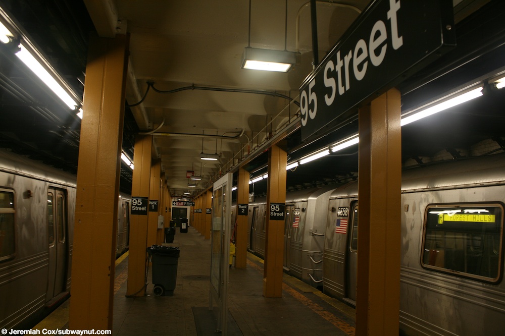
This underground station has two tracks and one island platform.[20] The R stops here at all times and is the route's southern terminus; the next station to the north is 86th Street.[32][33] The tracks end at bumper blocks at the south end of the platform.[34][35] North of this station, a center layup track forms just north of the diamond crossover, before ending at a bumper block just south of the 86th Street station.[34]
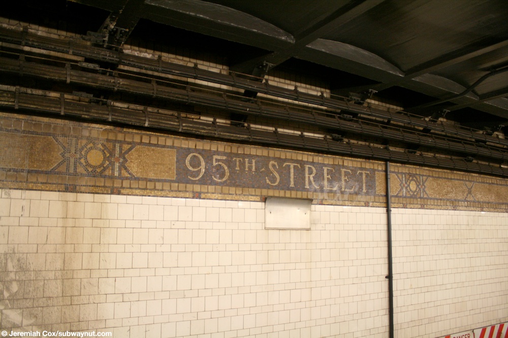
The platform has yellow painted I-beam columns and alternate ones have "95 Street" signs on them.[36] Both platform walls have their original mosaic trim line with name tablets reading "95TH STREET" along the entire station except for a small section at the north end, where the platform was extended in 1970.[37] Here, the wall is bare black.[38] The station was constructed with a signal tower and dispatcher's office.[20]
Exits
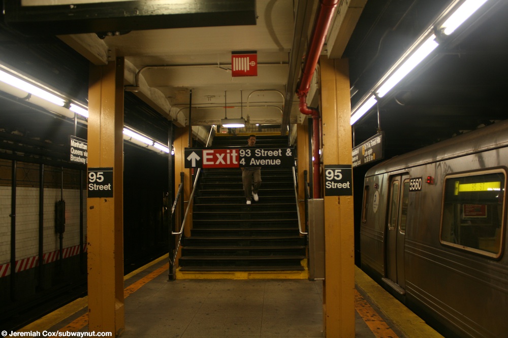
Entrance at 95th Street and 4th Avenue
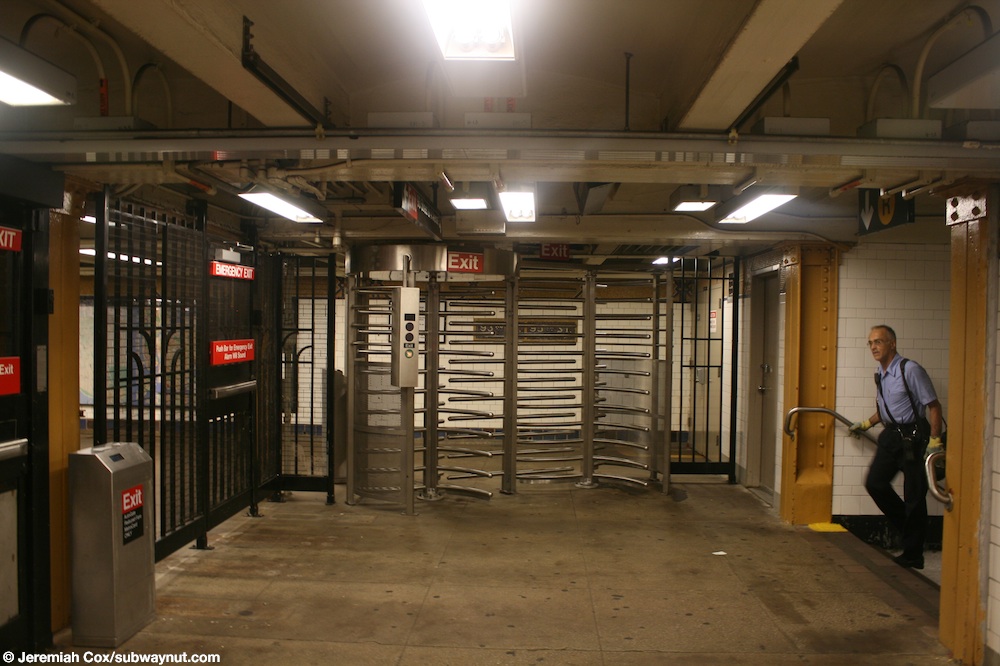
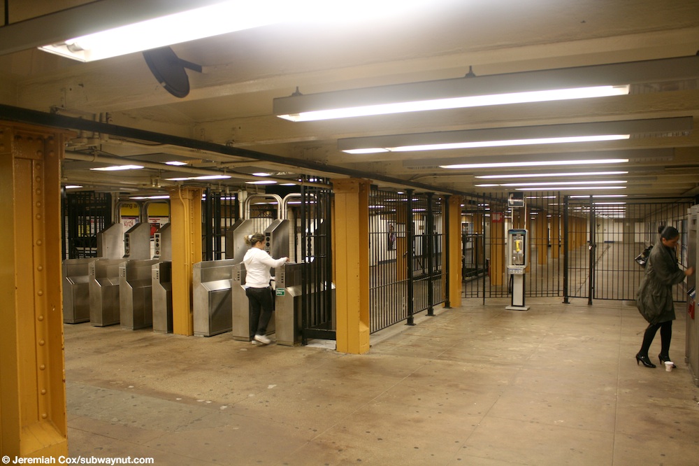
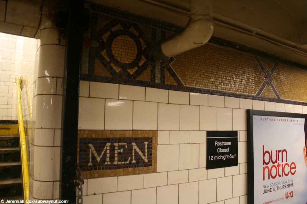
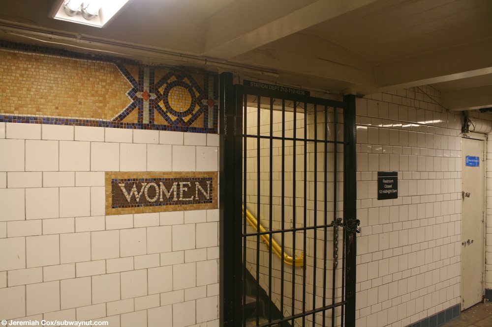
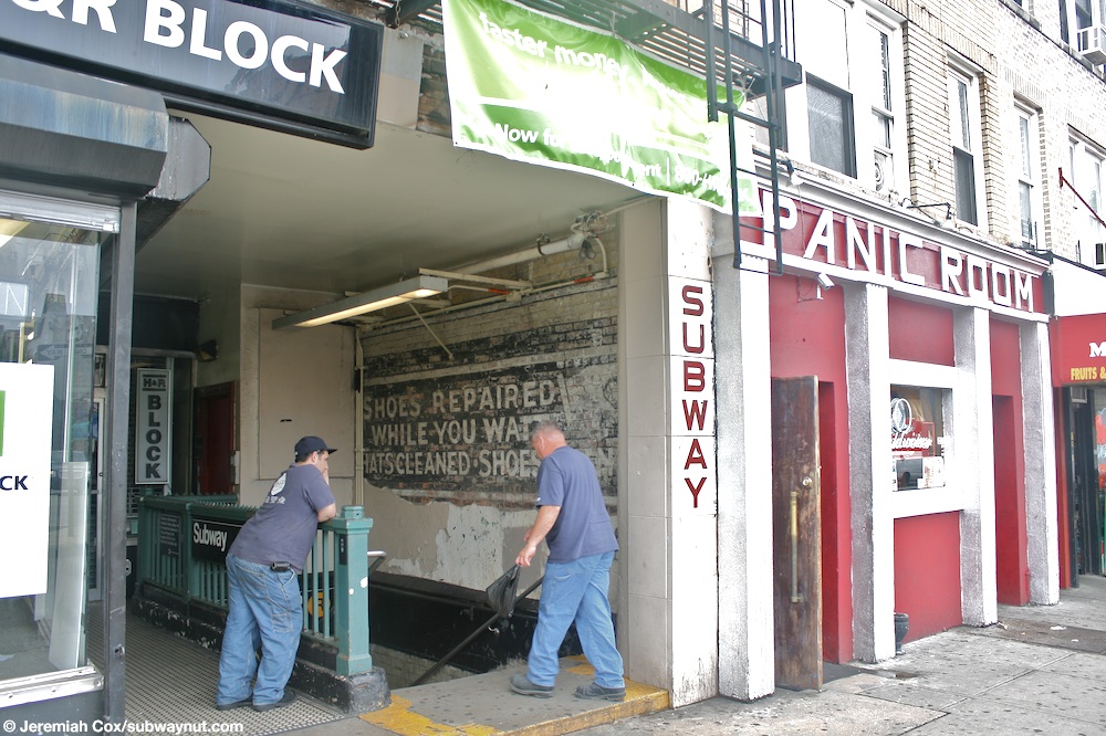
The station has two mezzanines above the platform and tracks. Mosaic directional signs indicate they were originally one full-length mezzanine.[39][40] The closed-off sections are now used for employee-only spaces.[40] The station's larger, full-time mezzanine is at the south end. It has two staircases from the platform, a turnstile bank,[41] a token booth,[42] and two restrooms.[43][44] In addition, two staircases going up to either western corners of Fourth Avenue and 95th Street. A passageway leads to another staircase on the east side of the intersection, built inside an alcove of 9425 Fifth Avenue.[45] The station's other mezzanine is unstaffed, containing one staircase from the platform,[46]high entry/exit turnstiles,[39] and two staircases going up to either southern corners of 93rd Street and Fourth Avenue.[47] Additional exits were planned at 94th Street, but were never built.[48]
Provisions for proposed extensions
Mosaic directional signs at the unstaffed mezzanine
The station is built on the west side of Fourth Avenue due to plans for a possible extension of the express tracks south of 59th Street.[49] This station had been built mainly to facilitate the Staten Island Tunnel or the "Narrows Tunnel", which would have necessitated express service, although the tunnel was never constructed.[50][51]
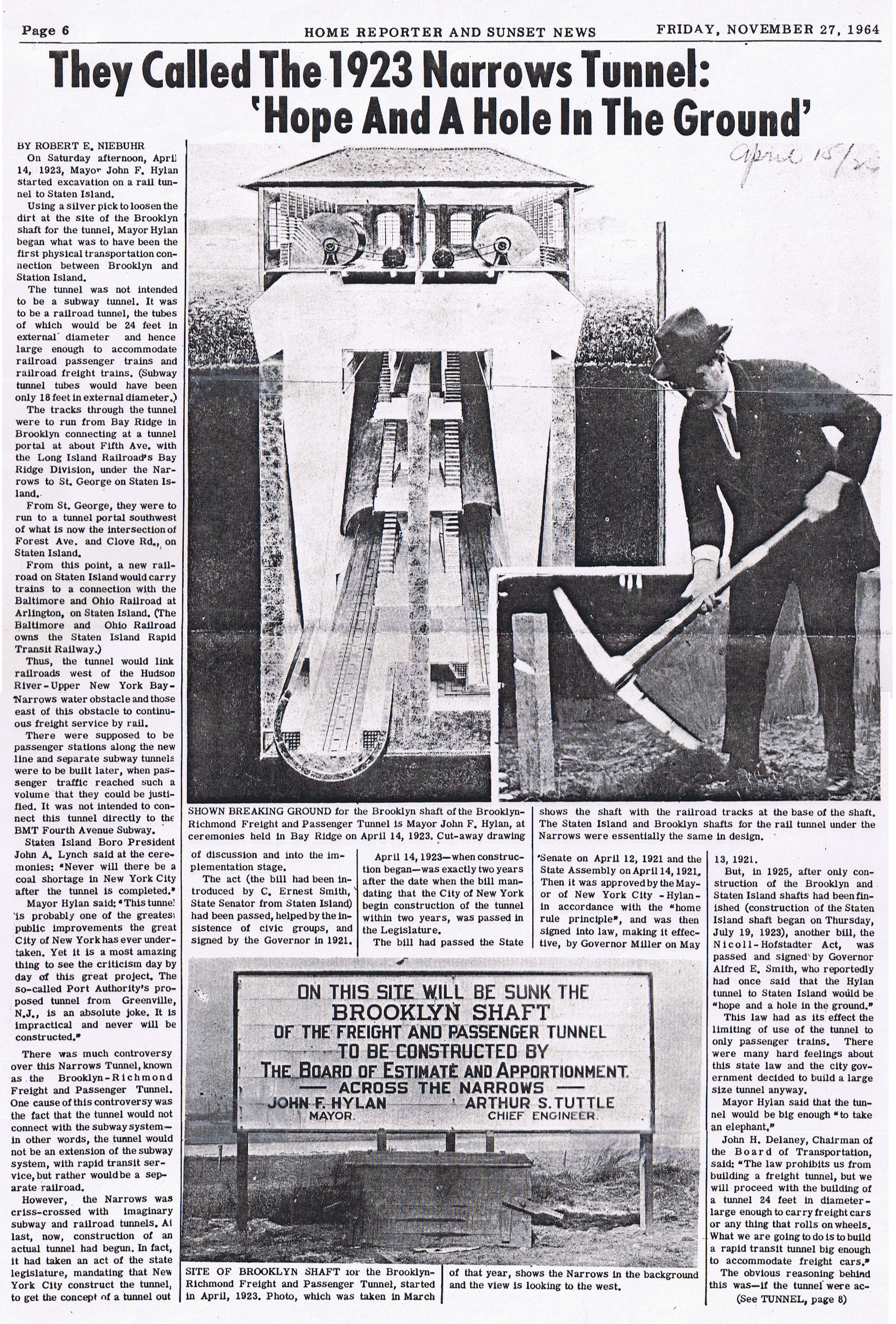
South of this station, there is a false wall at the end of the tracks for a planned extension to 100th or 101st Street[52] and into the never-built Staten Island "Narrows Tunnel", connecting the BMT line with the Staten Island Railway (SIRT) Main Line near its Grasmere station. The station would have also connected with the now-defunct South Beach Branch by disconnecting it from the SIRT main line, with the BMT Fourth Avenue Subway taking over service from the SIRT's Fort Wadsworth station to the Wentworth Avenue terminal. At the time it would have been a very different line had this tunnel been built, with through BMT service from Queensboro Plaza to Wentworth Avenue in Staten Island stopping at this station before proceeding to Staten Island, since this station is also the closest point to Staten Island. There were also plans to construct an underground storage yard here. The SIRT had been electrified in preparation for the tunnel, and had purchased subway cars similar to the AB Standards of the BMT.[53]
The tunnel plan was amended in 1919, moving its location north to Shore Road in Bay Ridge.[54] A groundbreaking ceremony was held by New York City Mayor John Hylan on April 14, 1923 in Bay Ridge[55][56] and in Staten Island on July 19.[57][58] In 1925, however—the year bids from contractors were to be entertained by the city—the project was halted and the project's engineering staff laid off.[57] Officially, the plan was delayed due to lack of funding,[59][60] but Hylan and New York City Board of Transportation (BOT) Chairman John Delaney also wanted to secure freight service for the tunnel.[57][61] These disagreements caused deadlocks between the parties involved.[57]
Later proposals surfaced to connect the station to the Verrazzano-Narrows Bridge, one of the world's longest suspension bridges, which follows the route of the planned tunnel. The bridge was completed in 1964 without provisions for rail traffic.[50][53][62]
^Rogoff, Dave (February 1969). "BMT Broadway Subway Platform Extensions"(PDF). New York Division Bulletin. 12 (1). Electric Railroaders' Association: 4. Archived from the original(PDF) on September 15, 2020. Retrieved May 22, 2020.
Note: Service variations, station closures, and reroutes are not reflected here. Stations with asterisks have no regular peak, reverse peak, or midday service on that route. See linked articles for more information.
Stations and line segments in italics are closed, demolished, or planned (temporary closures are marked with asterisks). Track connections to other lines' terminals are displayed in brackets. Struck through passenger track connections are closed or unused in regular service.
Roberts ParkBandstand, statue and Half Moon PavilionTypeUrban ParkLocationSaltaire, Shipley, City of Bradford, West YorkshireNearest cityBradfordCoordinates53°50′28″N 1°47′28″W / 53.841°N 1.791°W / 53.841; -1.791Area14 acres (5.7 ha)Created1871 (1871)DesignerWilliam GayEtymologyNamed in memory of Bertram Foster RobertsOperated byCity of Bradford, Parks and Landscape ServicesVisitorsup to 3,000 people per day[1]OpenOpen all yearStatu…
لمعانٍ أخرى، طالع الحازة (توضيح). قرية الحازة - قرية - تقسيم إداري البلد اليمن[1] المحافظة محافظة حجة المديرية مديرية وشحة العزلة عزلة بني رزق إحداثيات 16°03′17″N 43°25′25″E / 16.054722222222°N 43.423611111111°E / 16.054722222222; 43.423611111111 السكان التعداد السكاني 2…
Town in Saxony, Germany For the town in Saxony-Anhalt, see Taucha, Saxony-Anhalt. Town in Saxony, GermanyTaucha Town Coat of armsLocation of Taucha within Nordsachsen district Taucha Show map of GermanyTaucha Show map of SaxonyCoordinates: 51°22′48″N 12°29′37″E / 51.38000°N 12.49361°E / 51.38000; 12.49361CountryGermanyStateSaxonyDistrictNordsachsen Subdivisions9Government • Mayor (2022–29) Tobias Meier[1]Area • Total33.70&…
جائزة أفضل لاعب في أمريكا الجنوبية 2012معلومات عامةالرياضة كرة القدم مقدمة من صحيفة إل بايسآخر فائز نيمارتعديل - تعديل مصدري - تعديل ويكي بيانات نيمار أفضل لاعب في أمريكا الجنوبية 2012 منحت جائزة أفضل لاعب كرة قدم في أمريكا الجنوبية 2012 من قبل صحيفة «إل بايس» في الأوروغواي من خلا
Ørum Parochie van Denemarken Situering Bisdom Bisdom Aalborg Gemeente Thisted Coördinaten 56°48'56,999NB, 8°19'59,999OL Algemeen Inwoners (2004) 153 Leden Volkskerk (2004) 137 Overig Kerken Ørum Kirke Proosdij Sydthy Provsti Pastoraat Hvidbjerg Vesten Å-Ørum-Lodbjerg Foto's Portaal Denemarken Ørum is een parochie van de Deense Volkskerk in de Deense gemeente Thisted. De parochie maakt deel uit van het bisdom Aalborg en telt 137 kerkleden op een bevolking van 153 (2004). Hist…
ولاية وسط افريقيا تنظيم الدولة الإسلامية - ولاية وسط إفريقية نشط 2018 - الآن أيديولوجية سلفية جهادية مؤسس أبو ياسر حسن قادة أبو ياسر حسن، موسي بالوكو مقار موزمبيق جمهورية الكونغو الديمقراطية أوغندا (كقوة متمردة) جزء من تنظيم الدولة الإسلامية حلفاء عناصر تحالف أنصار ا…
British Crown Dependency consisting of several islands This article is about the whole territory of the Bailiwick of Guernsey. For the island, see Guernsey. British Crown Dependency in United KingdomBailiwick of GuernseyBailliage de Guernesey (French)Bailliage dé Guernési (Guernésiais)British Crown Dependency Coat of armsAnthem: Various: God Save the King and Sarnia CherieLocation of Bailiwick of Guernsey (circled)in the English Channel (red)Map of the Bailiwick, the …
Television production company Mutant Enemy ProductionsTypePrivately heldIndustryFilm industryGenreProduction companyFoundedLos Angeles, California U.S. (1996; 27 years ago (1996))FounderJoss WhedonHeadquartersLos Angeles, California, U.S.Key peopleJoss WhedonProductsFilmsTelevision seriesWeb series Mutant Enemy Productions is a production company that was created in 1996[1] by Joss Whedon to produce Buffy the Vampire Slayer. The company also produced the Buffy spin-off,…
Overview of mass media in Indonesia Part of a series on theCulture of Indonesia History Timeline Prehistoric Hinduism-Buddhism era Spread of Islam Portuguese era (1512–1605) VOC era (1603–1800) French and British era (1806–1816) Dutch East Indies (1800–1942) Japanese occupation (1942–45) National Revolution (1945–49) Liberal democracy era (1950–59) Guided Democracy (1959–65) Transitional period (1965–66) New Order (1966–98) Reformasi (since 1998) People Languages Traditions E…
Sporting event delegationSwitzerland at the1928 Summer OlympicsIOC codeSUINOCSwiss Olympic AssociationWebsitewww.swissolympic.ch (in German and French)in AmsterdamCompetitors133 in 15 sportsMedalsRanked 6th Gold 7 Silver 4 Bronze 4 Total 15 Summer Olympics appearances (overview)189619001904190819121920192419281932193619481952195619601964196819721976198019841988199219962000200420082012201620202024Other related appearances1906 Intercalated Games Switzerland competed at the 1928 Summer Olympic…
Israeli elite anti-terror unit You can help expand this article with text translated from the corresponding article in Hebrew. (July 2018) Click [show] for important translation instructions. Machine translation, like DeepL or Google Translate, is a useful starting point for translations, but translators must revise errors as necessary and confirm that the translation is accurate, rather than simply copy-pasting machine-translated text into the English Wikipedia. Do not translate text that …
Lecco–Mailand Strecke der Bahnstrecke Lecco–MailandStreckennummer (RFI):27Kursbuchstrecke (IT):180Streckenlänge:44 kmSpurweite:1435 mm (Normalspur)Stromsystem:3 kV =Höchstgeschwindigkeit:150 km/hZweigleisigkeit:ja Legende von Tirano 32,933 Lecco Endstation 214 m nach Como 29,713 Lecco Maggianico 207 m 27,515 Vercurago-San Girolamo (ehem. Bahnhof) 209 m 26,04630,404 Calolziocorte-Olginate 210 m nach Brescia Adda Airuno Nord (2.228 m) 24,184 Airuno ehem. Bahnhof…
Legislative body of the province of Agusan del Norte, Philippines This article needs additional citations for verification. Please help improve this article by adding citations to reliable sources. Unsourced material may be challenged and removed.Find sources: Agusan del Norte Provincial Board – news · newspapers · books · scholar · JSTOR (September 2020) (Learn how and when to remove this template message) Agusan del Norte Provincial Board Sangguniang Pa…
Wagakki Band discographyStudio albums6Live albums1Compilation albums2Video albums8[fn 1]EPs2Singles17[fn 2] The discography of the Japanese band Wagakki Band consists of six studio albums, two compilation albums, and seventeen singles released since 2014. Albums Studio albums List of studio albums, with selected details, chart positions and certifications Title Album details Peak positions RIAJcertification[1] JPN[2] TWN Vocalo Zanmai Released: April 23, 2014 Labe…
العلاقات اللاوسية النيبالية لاوس نيبال لاوس نيبال تعديل مصدري - تعديل العلاقات اللاوسية النيبالية هي العلاقات الثنائية التي تجمع بين لاوس ونيبال.[1][2][3][4][5] مقارنة بين البلدين هذه مقارنة عامة ومرجعية للدولتين: وجه المقارنة لاوس نيبال ال�…
Disambiguazione – Se stai cercando l'organizzazione territoriale successiva al Congresso di Vienna e alla relativa Restaurazione, vedi Suddivisioni amministrative dello Stato Pontificio in età contemporanea. Ritratto di papa Clemente XI del 1720 Sul finire del Cinquecento iniziò un processo di ristrutturazione degli assetti territoriali dello Stato della Chiesa che, dopo aver subito una vigorosa accelerazione nei primi decenni del XVIII secolo, durante i pontificati di Clemente XI (1700-1721…
Indian Hindi film DadagiriPromotional posterDirected byDeepak ShivdasaniProduced byDeepak ShivdasaniStarringDharmendraPadmini KolhapureGovindaCinematographyLawrence D'SouzaMusic byAnu MalikRelease date 30 January 1987 (1987-01-30) CountryIndiaLanguageHindi Dadagiri (transl. Hooliganism) is a 1987 Bollywood action film directed by Deepak Shivdasani, starring Dharmendra, Govinda, Amrish Puri and Padmini Kolhapure.[1][2] Dadagiri was successful movie of 1987 and…
Satte-shi幸手市 Satte Geographische Lage in Japan Satte (Japan) Region: Kantō Präfektur: Saitama Koordinaten: 36° 5′ N, 139° 44′ O36.078088888889139.72580555556Koordinaten: 36° 4′ 41″ N, 139° 43′ 33″ O Basisdaten Fläche: 33,95 km² Einwohner: 49.961(1. März 2021) Bevölkerungsdichte: 1472 Einwohner je km² Gemeindeschlüssel: 11240-2 Symbole Flagge/Wappen: Baum: Großblättrige Steineibe Blume: Kirschblüte Rathau…
Species of fish Salmo fibreni Conservation status Vulnerable (IUCN 3.1)[1] Scientific classification Domain: Eukaryota Kingdom: Animalia Phylum: Chordata Class: Actinopterygii Order: Salmoniformes Family: Salmonidae Genus: Salmo Species: S. fibreni Binomial name Salmo fibreniZerunian & Gandolfi, 1990 Salmo fibreni, or the Fibreno trout, is a freshwater salmonid fish, endemic to Lago di Posta Fibreno in central Italy.[1][2] The size of Lago di Posta Fibreno i…


_03.jpg)


")


")


")


")

