|
|
Název majáku
|
Obrázek
|
Souřadnice
|
Ostrov/Pevnina
|
Rok výstavby
|
Architekt/Stavitel
|
Ve správě/ Uzavřen
|
Výška majáku [m]
|
Výška světla [m n. m.]
|
Dosvit [nm (km)]
|
Charakteristika
|
Poznámka Zdroj
|
| 1
|
Ailsa Craig
|
![]()
|
Jižní Ayrshire
55°15′6″ s. š., 5°6′24″ z. d.
|
Ailsa Craig
|
1886
|
Thomas Stevenson,
David A Stevenson
|
Northern Lighthouse Board
|
11
|
18
|
17 (31)
|
Fl W 4s
|
památka kategorie B[4]
[5][6]
|
| 2
|
Ardnamurchan
|

|
Highland
56°43′38″ s. š., 6°13′34″ z. d.
|
pevnina
|
1849
|
Alan Stevenson
|
Northern Lighthouse Board
|
35
|
55
|
22 (44)
|
Fl (2) W 20s
|
památka kategorie A[7]
[8]
|
| 3
|
Auskerry
|

|
Orkneje
59°1′33″ s. š., 2°34′20″ z. d.
|
Auskerry
|
1866
|
David Stevenson,
Thomas Stevenson
|
Northern Lighthouse Board
|
34
|
34
|
20 (37)
|
Fl W 20s
|
památka kategorie B[9]
[10]
|
| 4
|
Barns Ness
|

|
East Lothian
55°59′14″ s. š., 2°26′43″ z. d.
|
pevnina
|
1899
|
David A Stevenson,
Charles A Stevenson
|
deaktivován 2005
|
37
|
36
|
10 (19)
|
Iso W 4s
|
památka kategorie B[11]
[12]
|
| 5
|
Barra Head
|

|
Vnější Hebridy
56°47′7″ s. š., 7°39′13″ z. d.
|
Barra Head
|
1833
|
Robert Stevenson
|
Northern Lighthouse Board
|
18
|
208
|
18 (33)
|
Fl W 15s
|
památka kategorie A[13]
[14]
|
| 6
|
Bass Rock
|

|
East Lothian
56°4′36″ s. š., 2°38′28″ z. d.
|
Bass Rock
|
1902
|
David Stevenson
|
Northern Lighthouse Board
|
20
|
46
|
10 (19)
|
Fl (3) W 20s
|
památka kategorie C
[15]
|
| 7
|
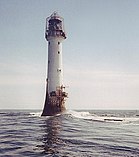
Bell Rock
|
|
Angus
56°26′3,07″ s. š., 2°23′14,27″ z. d.
|
Inchcape
|
1810
|
Robert Stevenson
|
Northern Lighthouse Board
|
36
|
28
|
18 (33)
|
Fl W 5s
|
památka kategorie A
[16][17]
|
| 8
|
Bressay
|

|
Shetlandy
60°7′12″ s. š., 1°7′17″ z. d.
|
Bressay
|
1858
|
David Stevenson,
Thomas Stevenson
|
Northern Lighthouse Board (do roku 2012), Lerwick Port Authority (od 2012)
|
16
|
32
|
23 (43),
10 (19)
|
Fl(2) W 20s
|
[18]
|
| 9
|
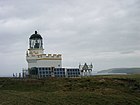
Brough of Birsay
|
|
Orkneje
59°8′13″ s. š., 3°20′21″ z. d.
|
Brough of Birsay
|
1925
|
David Alan Stevenson
|
Northern Lighthouse Board
|
11
|
52
|
18 (33)
|
FI(3) W 25s
|
[19][20]
|
| 10
|
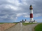
Buchan Ness
|
|
Aberdeenshire
57°28′13″ s. š., 1°46′28″ z. d.
|
pevnina
|
1827
|
Robert Stevenson
|
Northern Lighthouse Board
|
35
|
40
|
18 (33)
|
Fl W 5s.
|
památka kategorie A
[21][22]
|
| 11
|
Butt of Lewis
|

|
Vnější Hebridy
58°30′56″ s. š., 6°15′39″ z. d.
|
poloostrov Lewis
|
1862
|
David Stevenson
|
Northern Lighthouse Board
|
37
|
52
|
25 (46)
|
Fl W 5s.
|
[23]
|
| 12
|
Cantick Head
|

|
Orkneje
58°47′13,57″ s. š., 3°7′52,79″ z. d.
|
South Walls
|
1858
|
David Stevenson, Thomas Stevenson
|
Northern Lighthouse Board
|
22
|
35
|
13 (24),
18 (33)
|
Fl W 20s.
|
[24][25]
|
| 13
|
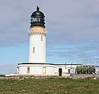
Cape Wrath
|
|
Highland
58°37′32″ s. š., 4°59′57″ z. d.
|
pevnina
|
1828
|
Robert Stevenson
|
Northern Lighthouse Board
|
20
|
122
|
22 (41)
|
Fl (4) W 30s.
|
[26]
|
| 14
|
Chanonry
|

|
Highland, Fortrose
57°34′26″ s. š., 4°5′34″ z. d.
|
poloostrov Black Isle
|
1846
|
Alan Stevenson
|
Northern Lighthouse Board
|
13
|
12
|
15 (28)
|
Oc W 6s.
|
památka kategorie A.[27]
[28]
|
| 15
|
Cloch
|

|
Inverclyde
55°56′32″ s. š., 4°52′43″ z. d.
|
pevnina
|
1797
|
Thomas Smith, Robert Stevenson
|
Clyde Port Authority
|
23
|
24
|
8 (15)
|
Fl. W 3s.
|
[29]
|
| 16
|
Copinsay
|
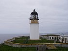
|
Orkneje
58°53′47″ s. š., 2°40′19″ z. d.
|
Copinsay
|
1915
|
David A Stevenson
|
Northern Lighthouse Board
|
16
|
79
|
21 (39)
|
FI(5) W 30s
|
památka kategorie B
[30]
|
| 17
|
Corran Point
|

|
Highland
56°43′15″ s. š., 5°14′32″ z. d.
|
pevnina
|
1817
|
Thomas Smith, Robert Stevenson
|
Northern Lighthouse Board
|
13
|
12
|
10 (19 bílá,
7 (13) červená a zelená
|
Iso WRG 4s.
|
[31][32]
|
| 18
|
Corsewall
|

|
Dumfries a Galloway
56°43′15″ s. š., 5°14′32″ z. d.
|
pevnina
|
1817
|
Robert Stevenson
|
Northern Lighthouse Board
|
34
|
34
|
22 (44)
|
Fl (5) W 30s
|
[33][34]
|
| 19
|
Covesea Skerries
|

|
Moray, Lossiemouth and Branderburgh
57°43′27″ s. š., 3°20′19″ z. d.
|
pevnina
|
1846
|
Alan Stevenson
|
Northern Lighthouse Board do 2012
|
36
|
49
|
24 (44) bílá,
20 (37) červená
|
Fl WR 20s.
|
[35]
|
| 20
|
Crammag Head
|
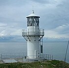
|
Dumfries a Galloway
54°39′54,56″ s. š., 4°57′53,38″ z. d.
|
pevnina
|
1913
(2009)[36]
|
David A Stevenson
|
Northern Lighthouse Board
|
7
|
35
|
18 (33)
|
Fl W 10s.
|
[37][38]
|
| 21
|
Cromarty
|

|
Highland
57°40′59″ s. š., 4°2′11″ z. d.
|
pevnina
|
1846
|
Alan Stevenson
|
deaktivován 2006[39]
|
13
|
18
|
15 (28) bílá.
11 () červená
|
Oc WR 10s
|
památka kategorie A
[40]
|
| 22
|
Davaar
|

|
Argyll a Bute
55°25′41″ s. š., 5°32′26″ z. d.
|
Davaar
|
1854
|
David Stevenson, Thomas Stevenson a John Barr & Co
|
Northern Lighthouse Board
|
20
|
37
|
23 (43)
|
FI(2) W 10s.
|
[41][42]
|
| 23
|
Dubh Artach
|

|
Argyll a Bute
56°8′0″ s. š., 6°37′54″ z. d.
|
Dubh Artach
|
1872
|
Thomas Stevenson
|
Northern Lighthouse Board
|
38
|
44
|
20 (37)
|
Fl(2) W 30s
|
[43][44][45]
|
| 24
|
Duncansby Head
|

|
Highland
58°38′38″ s. š., 3°1′31″ z. d.
|
pevnina
|
1924
|
David A Stevenson
|
Northern Lighthouse Board
|
11
|
67
|
22 (41)
|
Fl W 12 s
|
[46]
|
| 25
|
Dunnet Head
|
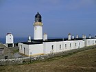
|
Highland
58°40′17″ s. š., 3°22′35″ z. d.
|
pevnina
|
1831
|
Robert Stevenson
|
Northern Lighthouse Board
|
20
|
105
|
23 (43)
|
Fl(4) W 30s
|
[47]
|
| 26
|
Eilean Glas
|

|
Vnější Hebridy
57°51′25″ s. š., 6°38′31″ z. d.
|
Scalpay
|
1789
|
Thomas Smith
|
Northern Lighthouse Board
|
30
|
43
|
23 (43)
|
Fl (3) W 20s.
|
[48]
|
| 27
|
Elie Ness
|

|
Fife
56°11′2″ s. š., 2°48′46″ z. d.
|
pevnina
|
1908
|
James Laurie
|
Forth Ports
|
11
|
15
|
17 (31)
|
Fl W 6s
|
památka kategorie C[49]
[50][51]
|
| 28
|
Esha Ness
|

|
Shetlandy
60°29′21″ s. š., 1°37′38″ z. d.
|
Mainland (Shetlandy)
|
1925
|
David A Stevenson
|
Northern Lighthouse Board
|
12
|
61
|
25 (46)
|
Fl W 12s
|
[52]
|
| 29
|
Fair Isle North
|

|
Shetlandy
59°33′8″ s. š., 1°36′35″ z. d.
|
Fair Isle
|
1892
|
David A Stevenson, Charles A Stevenson
|
Northern Lighthouse Board
|
14
|
80
|
22 (41)
|
FI(2) W 30s
|
|
| 30
|
South
|

|
Shatlandy
59°30′50″ s. š., 1°39′10″ z. d.
|
Fair Isle
|
1892
|
David A Stevenson, Charles A Stevenson
|
Northern Lighthouse Board
|
26
|
32
|
22 (41)
|
FI(2) W 30s
|
[53]
|
| 31
|
Fidra
|

|
East Lothian
56°4′23,56″ s. š., 2°47′6,38″ z. d.
|
Fidra
|
1885
|
David A Stevenson, Thomas Stevenson
|
Forth Ports
|
17
|
12
|
15 (28)
|
Fl(4) W 30s
|
památka kategorie C
[54]
|
| 32
|
Fife Ness
|

|
Fife
56°16′44″ s. š., 2°35′9″ z. d.
|
pevnina
|
1975
|
Peter H. Hyslop
|
Northern Lighthouse Board
|
5
|
12
|
21 (39) bílá,
20 (37) červená
|
Iso WR 10s.
|
[55]
|
| 33
|
Firths Voe
|

|
Shetlandy
60°27′13″ s. š., 1°10′40″ z. d.
|
Mainland (Shetlandy)
|
1909
|
David A Stevenson
|
Northern Lighthouse Board
|
9
|
9
|
15 (28) bílá.
10 (19) zelená,
10 (19) červená
|
Oc WRG 8s
|
[56]
|
| 34
|
Flannan Isles
|

|
Vnější Hebridy
58°17′18″ s. š., 7°35′17″ z. d.
|
Eilean Mòr
|
1899
|
David A Stevenson
|
Northern Lighthouse Board
|
23
|
101
|
20 (37)
|
Fl (2) W 30s.
|
|
| 35
|
Foula
|

|
Shetlandy
60°6′45″ s. š., 2°3′50″ z. d.
|
Foula
|
1986
|
James Johnson
|
Northern Lighthouse Board
|
8
|
36
|
18 (33)
|
FI(3) W 15s
|
[57]
|
| 36
|
Girdleness
|

|
Aberdeen City
57°8′20″ s. š., 2°2′55″ z. d.
|
pevnina
|
1833
|
Robert Stevenson
|
Northern Lighthouse Board
|
37
|
56
|
22 (41)
|
Fl(2) W 20s.
|
památka kategorie A [58] [59]
|
| 37
|
Holburn Head
|

|
Highland
58°36′54″ s. š., 3°32′24″ z. d.
|
pevnina
|
1862
|
David Stevenson, Thomas Stevenson
|
deaktivován 2003
|
17
|
23
|
15 (28)
|
Fl WR 10s
|
[60]
|
| 38
|
Holy Isle Inner
|

|
Severní Ayrshire
55°30′44″ s. š., 5°4′13″ z. d.
|
Holy Island
|
1877
|
David Stevenson, Thomas Stevenson
|
Northern Lighthouse Board
|
17
|
14
|
6 (11)
|
FI G 3s
|
[61]
|
| 39
|
Holy Isle Outer
|

|
Severní Ayrshire
55°31′2″ s. š., 5°3′39″ z. d.
|
Holy Island
|
1905
|
David Stevenson, Thomas Stevenson
|
Northern Lighthouse Board
|
23
|
38
|
25 (46)
|
FI(2) W 20s
|
[62]
|
| 40
|
Hoxa Head
|

|
Orkneje
58°49′19″ s. š., 3°2′5″ z. d.
|
South Ronaldsay
|
1901
1996
|
David A Stevenson
|
Northern Lighthouse Board
|
7
|
15
|
9 (17) bílá),
6 (11) červená)
|
FI WR 3s[63]
|
[64][65][66]
|
| 41
|
Hoy Sound High
|

|
Orkneje
58°56′8″ s. š., 3°16′23″ z. d.
|
Graemsay
|
1851
|
Alan Stevenson
|
Northern Lighthouse Board
|
33
|
35
|
20(37) bíá.16 (30) červená
|
Oc WR 8s
|
|
| 42
|
Hoy Sound Low
|

|
Orkneje
58°56′25″ s. š., 3°18′36″ z. d.
|
Graemsay
|
1851
|
Alan Stevenson
|
Northern Lighthouse Board
|
12
|
17
|
12 (22)
|
Iso W 3s
|
|
| 43
|
Hyskeir
|

|
Highland
56°58′8″ s. š., 6°40′51″ z. d.
|
Hyskeir
|
1904
|
David A Stevenson, Charles A Stevenson
|
Northern Lighthouse Board
|
39
|
41
|
24 (44)
|
Fl (3) W 30s.
|
[67]
|
| 44
|
Inchkeith
|
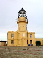
|
Fife
56°2′1″ s. š., 3°8′10″ z. d.
|
Inchkeith
|
1804
|
Thomas Smith, Robert Stevenson
|
Forth Ports (od června 2013), Northern Lighthouse Board (od 1804 do června 2013)
|
19
|
67
|
14 (26)
|
Fl W 15s.
|
[68]
|
| 45
|
Isle of May
|

|
Fife
56°11′8″ s. š., 2°33′27″ z. d.
|
Isle of May
|
1816
|
Robert Stevenson
|
Northern Lighthouse Board
|
24
|
73
|
22 (41)
|
Fl(2) W 15s
|
|
| 46
|
Isle of May Low
|

|
Fife
56°11′16,2″ s. š., 2°33′26,28″ z. d.
|
Isle of May
|
1843
|
Robert Stevenson
|
deaktivovám 1887
|
12
|
|
|
|
[69]
|
| 47
|
Old Isle of May
|

|
Fife
56°11′9″ s. š., 2°33′24″ z. d.
|
Isle of May
|
1636
1635
|
|
James Maxwell, 1st Earl of Dirletoun
|
|
|
|
|
[70]
|
| 48
|
Killantringan
|

|
Dumfries a Galloway 54°51′42,37″ s. š., 5°8′48,84″ z. d.
|
pevnina
|
1900
|
David A Stevenson
|
deaktivován 2007
|
22
|
49
|
25 (46)
|
FI(2) W 15s
|
[71]
|
| 49
|
New Kinnaird Head
|

|
Aberdeenshire
57°41′53″ s. š., 2°0′15″ z. d.
|
pevnina
|
1991
|
|
Northern Lighthouse Board
|
10
|
25
|
22 (41)
|
Fl W 5s
|
[72]
|
| 50
|
Kinnaird Head
|

|
Aberdeenshire
57°41′51″ s. š., 2°0′14″ z. d.
|
pevnina
|
1787
|
Thomas Smith
|
Northern Lighthouse Board (od 1787 do 1991), Museum of Scottish Lighthouses (od 1991)
|
22
|
|
|
W Fl 15s
|
|
| 51
|
Lady Isle
|

|
Jižní Ayrshire
55°31′38″ s. š., 4°44′2″ z. d.
|
ostrov Lady
|
1903
|
David A Stevenson
|
Northern Lighthouse Board
|
15
|
19
|
11 (20)
|
Fl (4) W 30 s
|
[73][74][75]
|
| 52
|
Lismore
|

|
Argyll a Bute
56°27′20″ s. š., 5°36′27″ z. d.
|
Eilean Musdile
|
1833
|
Robert Stevenson
|
Northern Lighthouse Board
|
26
|
31
|
17 /31)
|
Fl W 10s.
|
[76]
|
| 53
|
Little Cumbrae Old
|
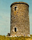
|
Severní Ayrshire
55°43′15″ s. š., 4°57′29″ z. d.
|
Little Cumbrae Island
|
1757
|
James Ewing
|
1757–1793
|
8,5
|
|
|
|
[77]
|
| 54
|
Cumbrae
|

|
Severní Ayrshire
55°43′16″ s. š., 4°58′1″ z. d.
|
Little Cumbrae Island
|
1793
|
Thomas Smith
|
Northern Lighthouse Board
|
11
|
28
|
|
|
|
| 55
|
Nový maják Little Cumbrae
|

|
Severní Ayrshire
55°43′14″ s. š., 4°58′2″ z. d.
|
Little Cumbrae Island
|
1997
|
|
Clyde Port Authority
|
|
28
|
14 (26
|
FI W 6s
|
|
| 56
|
Little Ross
|

|
Dumfries a Galloway
54°45′57″ s. š., 4°5′6″ z. d.
|
ostrov Little Ross
|
1843
|
Alan Stevenson
|
Northern Lighthouse Board
|
22
|
50
|
12 (22)
|
Fl W 5 s
|
[78][79]
|
| 57
|
Lother Rock Light
|
|
Orkneje
58°43′48″ s. š., 2°58′42″ z. d.
|
Lother Rock
|
1910
|
David A Stevenson
|
Northern Lighthouse Board
|
12
|
13
|
6 (11)
|
Fl W 2s
|
[80][81]
|
| 58
|
Old Monach
|

|
Vnější Hebridy
57°31′33″ s. š., 7°41′46″ z. d.
|
Shillay
|
1864
|
Thomas Stevenson, David Stevenson
|
Northern Lighthouse Board
|
41
|
47
|
18 (33)
|
|
|
| 59
|
New Monach
|

|
Vnější Hebridy
57°31′33″ s. š., 7°41′44″ z. d.
|
Shillay
|
1997
|
|
Northern Lighthouse Board
|
5,5
|
|
10 (19)
|
Fl (2) W 15s.
|
|
| 60
|
Muckle Flugga
|
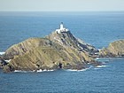
|
Shetlandy
60°51′19″ s. š., 0°53′7″ z. d.
|
Muckle Flugga
|
1854
|
Thomas Stevenson, David Stevenson
|
Northern Lighthouse Board
|
20
|
66
|
22 (41)
|
Fl (2) W 20s.
|
|
| 61
|
Mull of Galloway
|

|
Dumfries a Galloway
54°38′6″ s. š., 4°51′26″ z. d.
|
pevnina
|
1830
|
Robert Stevenson
|
Northern Lighthouse Board
|
26
|
99
|
28 (52)
|
FI W 20s
|
|
| 62
|
Mull of Kintyre
|

|
Argyll a Bute
55°18′38″ s. š., 5°48′12″ z. d.
|
pevnina
Mull of Kintyre
|
1788
|
Thomas Smith
|
Northern Lighthouse Board
|
12
|
91
|
24 (44)
|
Fl (2) W 20s
|
památka kategorie A
[82]
|
| 63
|
Neist Point
|

|
Highland
57°25′24″ s. š., 6°47′18″ z. d.
|
ostrov Skye
|
1909
|
David A Stevenson
|
Northern Lighthouse Board
|
19
|
43
|
16 (30)
|
Fl W 5s
|
památka kategorie B
|
| 64
|
North Rona
|

|
Vnější Hebridy
59°7′17″ s. š., 5°48′53″ z. d.
|
North Rona
|
1984
|
|
Northern Lighthouse Board
|
13
|
114
|
24 (44)
|
Fl (3) W 20 s
|
|
| 65
|
North Ronaldsay
|
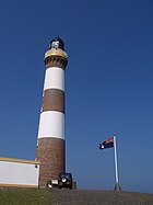
|
Orkneje
59°23′23″ s. š., 2°22′53″ z. d.
|
North Ronaldsay
|
1852
|
Alan Stevenson
|
Northern Lighthouse Board
|
42
|
43
|
24 (41)
|
Fl W 10s
|
[83]
|
| 66
|
Dennis Head Old Beacon
|

|
Orkneje
59°23′3″ s. š., 2°22′17″ z. d.
|
North Ronaldsay
|
1789
|
Thomas Smith, Robert Stevenson
|
deaktivován 1809
|
21
|
|
|
|
Scheduled monument od 1997
(kulturní památka)
|
| 67
|
Noss Head
|

|
Highland
58°28′44″ s. š., 3°3′3″ z. d.
|
pevnina
|
1849
|
Alan Stevenson
|
Northern Lighthouse Board
|
18
|
53
|
25 (46) bílá,
21 (39) červená
|
Fl WR 20s
|
[84]
|
| 68
|
Noup Head
|

|
Orkneje
59°19′52″ s. š., 3°4′13″ z. d.
|
ostrov Westray
|
1898
|
David A Stevenson, Charles A Stevenson
|
Northern Lighthouse Board
|
24
|
79
|
22 (41)
|
Fl W 30s.
|
|
| 69
|
Ornsay
|

|
Highland
57°8′36″ s. š., 5°46′52″ z. d.
|
Ornsay
|
1857
|
Thomas Stevenson, David Stevenson
|
Northern Lighthouse Board
|
19
|
18
|
12 (22)
|
Oc W 8 s
|
[85]
|
| 70
|
Bound Skerry
|

|
Shetlandy
60°25′28″ s. š., 0°43′41″ z. d.
|
Bound Skerry
|
1858
|
David Stevenson, Thomas Stevenson
|
Northern Lighthouse Board
|
30
|
44
|
20 (37)
|
Fl W 20s
|
|
| 71
|
Oxcars
|

|
Fife
56°1′21″ s. š., 3°16′49″ z. d.
|
skalisko
|
1886
|
David A Stevenson, Thomas Stevenson
|
Forth Ports
|
22
|
16
|
13 (24) bílá,
12 (22) červená[86]
|
Fl(2) WR 7s
|
památka kategorie B
[87]
|
| 72
|
Pentland Skerries High Light
|

|
Orkneje
58°41′25″ s. š., 2°55′29″ z. d.
|
Muckle Skerry
|
1794
|
Thomas Smith, Robert Stevenson
|
Northern Lighthouse Board
|
36
|
52
|
23 (43)
|
Fl (3) W 30s.
|
[88]
|
| 73
|
Pladda
|

|
Severní Ayrshire
55°25′30″ s. š., 5°7′6″ z. d.
|
Pladda
|
1790
|
Thomas Smith
|
Northern Lighthouse Board
|
29
|
40
|
17 (31)
|
Fl (3) W 30 s
|
|
| 74
|
Fethaland
|

|
Shetlandy
60°38′3″ s. š., 1°18′41″ z. d.
|
Shetland Mainland
|
1977
|
|
Northern Lighthouse Board
|
7
|
67
|
19 (35) bílá,15 (28) červená
|
Fl(3) WR 15s
|
[89]
|
| 75
|
Point of Sleat
|

|
Highland
57°1′6″ s. š., 6°1′3″ z. d.
|
ostrov Skye
|
2003
|
|
Northern Lighthouse Board
|
5
|
20
|
9 (17)
|
Fl W 3s
|
|
| 76
|
Rattray Head
|

|
Aberdeenshire
57°36′36″ s. š., 1°48′59″ z. d.
|
skála s hrází
|
1895
|
David A Stevenson, Charles A Stevenson
|
Northern Lighthouse Board
|
34
|
28
|
18 (33)
|
Fl (3) W 30s.
|
|
| 77
|
Rinns of Islay
|

|
Argyll a Bute
55°40′23″ s. š., 6°30′48″ z. d.
|
Orsay
|
1825
|
Robert Stevenson
|
Northern Lighthouse Board
|
29
|
46
|
24 (44)
|
Fl W 5s
|
[90]
|
| 78
|
Rona
|

|
Higland
57°34′41″ s. š., 5°57′33″ z. d.
|
South Rona
|
1825
|
David Stevenson, Thomas Stevenson
|
Northern Lighthouse Board
|
13
|
69
|
19 (35)
|
FI W 12s
|
|
| 79
|
Rua Reidh
|

|
Higland
57°51′32″ s. š., 5°48′43″ z. d.
|
pevnina
|
1912
|
David A Stevenson
|
Northern Lighthouse Board
|
25
|
37
|
24 (44)
|
Fl (4) W 15s
|
|
| 80
|
Rubha nan Gall
|

|
Argyll a Bute
56°38′19″ s. š., 6°3′58″ z. d.
|
ostrov Mull
|
1857
|
Thomas Stevenson, David Stevenson
|
Northern Lighthouse Board
|
19
|
17
|
15 (28)
|
FI W 5s
|
|
| 81
|
Ruvaal
|

|
Argyll a Bute
55°56′11″ s. š., 6°7′24″ z. d.
|
Islay
|
1859
|
David Stevenson, Thomas Stevenson
|
Northern Lighthouse Board
|
34
|
45
|
19 (35)
|
Fl (3) W 15s
|
|
| 82
|
Sanda Island
|

|
Argyll a Bute
55°16′29″ s. š., 5°34′58″ z. d.
|
Sanda Island
|
1850
|
Alan Stevenson
|
Northern Lighthouse Board
|
15
|
50
|
15 (28)
|
Fl W 10s
|
|
| 83
|
Scarinish
|

|
Argyll a Bute
56°30′1″ s. š., 6°48′15″ z. d.
|
Tiree
|
1897
|
David A Stevenson
|
Northern Lighthouse Board
|
3,5
|
11
|
12 (22)
|
Fl W 3s
|
|
| 84
|
Scurdie Ness
|
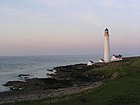
|
Angus
56°42′6″ s. š., 2°26′14″ z. d.
|
pevnina
|
1870
|
David Stevenson
|
Northern Lighthouse Board
|
39
|
38
|
23 (43)
|
Fl (3) W 20s.
|
|
| 85
|
Skerryvore
|
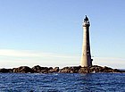
|
Argyll a Bute
56°19′23″ s. š., 7°6′58″ z. d.
|
Skerryvore
|
1844
|
Alan Stevenson
|
Northern Lighthouse Board
|
48
|
46
|
23 (43)
|
FI W 10s
|
|
| 86
|
Southerness
|

|
Dumfries a Galloway
54°52′20″ s. š., 3°35′36″ z. d.
|
pevnina
|
1749
|
Deaktivován v roce 1931
|
|
10
|
17
|
|
|
|
| 87
|
St. Abbs
|

|
Scottish Borders
55°54′58″ s. š., 2°8′20″ z. d.
|
pevnina
|
1862
|
Alan Stevenson, David Stevenson
|
Northern Lighthouse Board
|
9
|
68
|
26 (48)
|
Fl W 10s
|
|
| 88
|
Start Point
|

|
Orkneje
59°16′39″ s. š., 2°22′33″ z. d.
|
Sanday
|
1806
|
Robert Stevenson
|
Northern Lighthouse Board
|
25
|
24
|
18 (33)
|
Fl (2) W 20s.
|
|
| 89
|
Stoer Head
|

|
Highland
58°41′45″ s. š., 3°7′0″ z. d.
|
pevnina
|
1870
|
Thomas Stevenson, David Stevenson
|
National Trust for Scotland,
Northern Lighthouse Board
|
14
|
59
|
24 (44)
|
 Fl W 15s Fl W 15s
|
|
| 90
|
Strathy Point
|

|
Highland
58°35′55″ s. š., 4°1′7″ z. d.
|
pevnina
|
1958
|
Peter H. Hyslop
|
Northern Lighthouse Board
do roku 2012)
|
14
|
45
|
26 (48)
|
Fl W 20s.
|
|
| 91
|
Stroma
|

|
Highland
58°41′45″ s. š., 3°7′0″ z. d.
|
ostrov Stroma
|
1890
|
Charles A Stevenson, David A Stevenson
|
Northern Lighthouse Board
|
23
|
32
|
20 (37)
|
FI(2) W 20s
|
|
| 92
|
Sule Skerry
|

|
Orkneje
59°5′3″ s. š., 4°24′24″ z. d.
|
Sule Skerry
|
1895
|
David A Stevenson, Charles A Stevenson
|
Northern Lighthouse Board
|
27
|
34
|
21 (39)
|
Fl (2) W 15s
|
|
| 93
|
Sumburgh Head
|
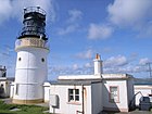
|
Shetandy
59°51′14″ s. š., 1°16′29″ z. d.
|
Mainland (Shetlandy)
|
1821
|
Robert Stevenson
|
Northern Lighthouse Board
|
17
|
91
|
23 (43)
|
Fl (3) W 30s.
|
|
| 94
|
Tarbat Ness
|

|
Highland
57°51′54″ s. š., 3°46′36″ z. d.
|
pevnina
|
1830
|
Robert Stevenson
|
Northern Lighthouse Board
|
41
|
53
|
24 (44)
|
Fl(4) W 30s
|
|
| 95
|
Tiumpan Head
|

|
Vnější Hebridy
58°15′39,33″ s. š., 6°8′20,09″ z. d.
|
Lewis
|
1900
|
David A Stevenson, Charles A Stevenson
|
Northern Lighthouse Board
|
21
|
55
|
25 (46)
|
Fl (2) W 15s.
|
|
| 96
|
Todhead
|

|
Aberdeenshire
56°53′2,09″ s. š., 2°12′55,18″ z. d.
|
pevnina
|
1897
|
David A Stevenson
|
Northern Lighthouse Board (do roku 2007)
Deaktivován 2007
|
13
|
41
|
18 (33)
|
|
památka kategorie B [91]
|
| 97
|
Tor Ness
|

|
Orkneje
56°53′2″ s. š., 2°12′55″ z. d.
|
Hoy
|
1980
|
John Smith
|
Northern Lighthouse Board
|
8
|
21
|
17 (31)
|
Fl W 5s
|
|
| 98
|
Toward Point
|

|
Argyll a Bute
55°51′44″ s. š., 4°58′47″ z. d.
|
pevnina
|
1812
|
Robert Stevenson
|
Clyde Port Authority
|
19
|
21
|
22 (41)
|
Fl. W 10s
|
|
| 99
|
Turnberry
|
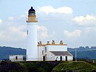
|
Jižní Ayrshire
55°19′33″ s. š., 4°50′41″ z. d.
|
pevnina
|
1873
|
David Stevenson, Thomas Stevenson
|
Northern Lighthouse Board
|
24
|
29
|
24
|
 Fl W 15s (44) Fl W 15s (44)
|
|
| 100
|
Ushenish
|
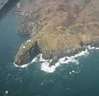
|
Vnější Hebridy
57°17′54″ s. š., 7°11′35″ z. d.
|
South Uist
|
1857
|
Thomas Stevenson, David Stevenson
|
Northern Lighthouse Board
|
12
|
54
|
19 (35)
|
FI WR 20s
|
|
| 101
|
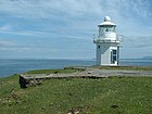
Vaternish
|
|
Highland
57°36′29″ s. š., 6°38′3″ z. d.
|
Skye
|
1980
|
David A Stevenson, Charles A Stevenson
|
Northern Lighthouse Board
|
7
|
21
|
8 (15)
|
Fl W 20s.
|
|
| 102
|
Vaternish Point
|
|
Highland
57°36′29″ s. š., 6°38′3″ z. d.
|
Skye
|
1924
|
John Smith
|
Northern Lighthouse Board
|
|
|
|
|
|
| 103
|
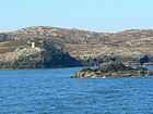
Weavers Point
|
|
Vnější Hebridy
57°36′30″ s. š., 7°6′0″ z. d.
|
North Uist
|
1980
|
John Smith
|
Northern Lighthouse Board
|
4
|
24
|
7 (13)
|
Fl W 3s
|
|